
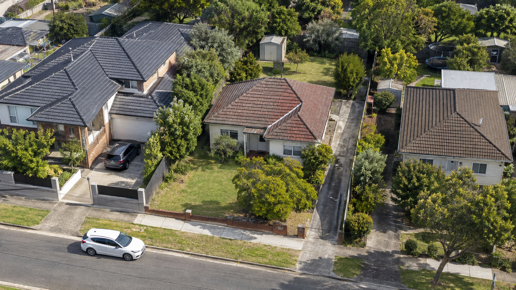
Minimum Lot Size Australia: Why Land Size Alone Does Not Mean You Can Subdivide
A block can look big enough on the listing and still fail as a subdivision site.
The trap is assuming that one number — the land size — tells you the answer. In reality, minimum lot size is only one planning control. Frontage, access, shape, slope, services, overlays, existing buildings and council rules can all change whether the deal works.
For everyday investors, the goal is not to become a town planner. The goal is to avoid building a feasibility around a yield that the site cannot realistically deliver.
This guide explains how to think about minimum lot size before you spend serious money on a subdivision opportunity.
Start with the exact subdivision idea
Before checking rules, write down the proposal you are testing.
“Can this block be subdivided?” is too broad. A better first-pass question is:
- Can the existing house stay and one rear lot be created?
- Can the house be demolished and the land split into two lots?
- Is the proposal a Torrens title subdivision, strata subdivision or community title arrangement?
- Will the new lots each support a dwelling that suits the local market?
- Is the exit to sell the lots, build and sell, or hold one or more dwellings?
Those details matter because different subdivision types can be treated differently under local planning controls. A block that cannot be split one way may have a different pathway under another structure, but that is not something to guess from the land size alone.
Your first job is to define the pathway, then test the controls that apply to that pathway.
Minimum lot size is a threshold, not an approval
Minimum lot size generally tells you the minimum area required for a new lot under a planning instrument or local planning scheme.
In NSW, the Planning Portal’s Environmental Planning Instrument Minimum Lot Size dataset identifies the minimum lot size permitted on land as designated by the relevant environmental planning instrument. The NSW Spatial Viewer can help users inspect planning map layers. The dataset directs users to the relevant planning instrument and cautions against making a decision without independent advice.
In Queensland, development assessment is generally handled through local government planning schemes, with development categories and assessment requirements applying to the proposal. Brisbane City Council’s subdivision fact sheet, for example, tells owners to check the zone, overlays and neighbourhood plans, then check minimum lot sizes and frontages for the relevant zone.
In Victoria, Planning Victoria’s property report and VicPlan tools help users identify the zone and overlays applying to land, with the detailed planning scheme provisions then needing to be read for the actual controls.
The practical point is simple: there is no single national subdivision number. The answer depends on the state, council area, zone, overlays, local provisions and exact proposal.
A site can meet the minimum area and still fail
A common beginner mistake is this:
“The block is 800 square metres and the minimum lot size is 400 square metres, so it can be split in two.”
Maybe. Maybe not.
A subdivision still needs to work physically, legally and commercially. The first-pass checks usually include:
- whether each new lot can meet the required minimum area;
- whether each lot has enough frontage or lawful access;
- whether a rear lot or battle-axe handle is allowed and whether the access handle counts toward lot area;
- whether existing buildings sit in the wrong place;
- whether the lots can be serviced by water, sewer, stormwater, power and telecommunications;
- whether overlays affect flooding, bushfire, heritage, vegetation, biodiversity or character;
- whether driveway grades, vehicle turning, parking and waste collection can work;
- whether trees, easements or infrastructure reduce the usable area;
- whether contributions, civil works and authority conditions change the cost; and
- whether the finished product is something buyers or renters actually want.
Minimum lot size is only the beginning of the question.
Frontage and access can quietly change the yield
A block may have enough total area but not enough practical frontage.
For example, a rear-lot subdivision may need a compliant driveway width, safe access, stormwater design, service connections and a building envelope that still works after the access handle is allowed for. If the existing house is too close to the side boundary, the access solution may require demolition, redesign or a lower-yield outcome.
Frontage also affects the quality of the finished product. Two narrow lots may technically meet a control but still produce awkward homes, poor parking, weak resale appeal or higher build costs.
This is where investors need to slow down. A site is not valuable because it looks divisible on paper. It is valuable if the new lots can be approved, serviced, built, financed and sold or held at numbers that still make sense.
Overlays can override the easy answer
A minimum lot size map does not tell the whole story.
Planning overlays and local controls may add extra investigation or restrictions. Depending on the location, these may include:
- flood planning controls;
- bushfire risk controls;
- heritage or character restrictions;
- significant landscape or vegetation controls;
- biodiversity or environmental constraints;
- drainage and waterway controls;
- coastal or erosion controls; and
- infrastructure or transport corridors.
An overlay does not automatically kill a deal. It may simply mean extra reports, design changes, referral requirements, longer assessment time or more conservative feasibility assumptions.
The danger is treating the subdivision as “obvious” before those checks are done.
A practical first-pass scenario
Imagine an older house on an 820-square-metre block.
The agent says the land is “ideal for subdivision”. The online planning map appears to show a 400-square-metre minimum lot size. At first glance, two lots might seem possible.
Before relying on that assumption, test the deal like this:
- Confirm the planning controls
Check the zone, minimum lot size map, overlays and council subdivision provisions. Save the source documents and note the date checked.
- Test the lot maths properly
Do not just divide 820 by two. Ask whether the proposed access handle, road widening, easements or unusable land affect the lot area calculation.
- Check frontage and access
Measure the side setback beside the existing dwelling. If a driveway cannot fit, the “retain and subdivide” strategy may become a demolition strategy.
- Check services and stormwater
Confirm whether each proposed lot can connect to required services and lawfully manage stormwater. Do not assume nearby infrastructure is available or adequate.
- Sketch a realistic building envelope
Each new lot needs to support a dwelling that can meet setbacks, private open space, parking, access, overshadowing and market expectations.
- Price the conditions
Subdivision approval often comes with works and conditions. These can include drainage, driveways, service upgrades, contributions, survey, civil works and authority certificates.
- Re-run the feasibility at the lower-yield case
If the concept only works as two lots, test what happens if the site becomes one dwelling plus renovation, a different title structure, or a no-deal.
This process does not replace a planner, surveyor, engineer or lawyer. It simply stops the investor from falling in love with the headline land size before the deal has been tested.
TPC deal lens: value the approved pathway, not the backyard
When reviewing a possible subdivision site, separate the land from the pathway.
The land is what exists today. The pathway is the set of approvals, works, services, costs and market outcomes needed to turn that land into saleable or rentable product.
A weak feasibility often prices the site as if the pathway is already solved. A disciplined feasibility asks:
- What subdivision pathway are we actually testing?
- Which controls support it?
- Which controls threaten it?
- What needs professional confirmation before an offer becomes unconditional?
- What costs have not been priced yet?
- What happens if the approved yield is lower than expected?
If the seller wants a price based on a clean two-lot subdivision, but the site still has unresolved access, stormwater and overlay questions, that risk should be reflected in the offer structure, due diligence period or decision to walk away.
Your minimum lot size checklist
Before treating a site as a subdivision opportunity, check:
- the current zone and planning scheme controls;
- the mapped minimum lot size for the exact property;
- whether the minimum lot size applies to the subdivision type proposed;
- frontage, width, depth and shape requirements;
- access rules for rear lots or battle-axe lots;
- whether access handles count toward lot area;
- overlays and constraints that may add assessment risk;
- existing building position and whether it can remain;
- sewer, water, stormwater, power and telecommunications connections;
- easements, title restrictions and covenants;
- tree, slope, retaining wall and drainage issues;
- likely civil works, contributions and authority conditions;
- comparable sales for the proposed end product; and
- advice needed from a town planner, surveyor, engineer, property lawyer, builder and tax adviser.
Key Takeaway
Minimum lot size is not the same as subdivision approval.
Use it as an early filter, then test frontage, access, overlays, services, title constraints, buildability, costs and resale evidence before you rely on the yield. A good deal is not the block with the biggest backyard. It is the site where the approved pathway, costs and exit still make sense after proper due diligence.
Your Turn
When you look at a possible subdivision site, what would you check before accepting the agent’s claim that the land is “development potential”?
Sources and boundaries
Sources checked 15 September 2026.
- NSW Planning Portal — Spatial Viewer terms and planning information notes. Used for: NSW Spatial Viewer access to planning maps, EPI spatial datasets and caution that portal datasets/maps should be checked carefully against planning instruments and official maps. (Checked 15 September 2026)
- NSW Planning Portal Open Data — Environmental Planning Instrument - Minimum Lot Size (LSZ). Used for: NSW minimum lot size spatial dataset identifies minimum lot size permitted on land as designated by relevant environmental planning instrument; dataset purpose/update/licensing context. (Checked 15 September 2026)
- Planning Victoria — Planning property report. Used for: VicPlan/property report can be used to search planning information for a property and identify zones and overlays. (Checked 15 September 2026)
- Queensland Government — What is development assessment? Used for: Queensland development assessment categories and local governments generally regulating land use and new development through local planning schemes. (Checked 15 September 2026)
- Brisbane City Council — Subdividing land fact sheet, Brisbane City Plan 2014. Used for: Subdivision/reconfiguring a lot requires an application in Brisbane; owners should check zones, overlays, neighbourhood plans, minimum lot sizes and frontages; site constraints may affect subdivision suitability. (Checked 15 September 2026)
This article is general education, not personalised planning, legal, financial, tax, privacy, safety or building advice. Requirements and outcomes vary by jurisdiction, site, contract, structure and circumstances. Check current information with the relevant authority and appropriately qualified advisers.
 Learn with Jason & AmyBuild practical small-scale property development skills with experienced mentors.Enquire now
Rate this article
Guest rating: select 1 star for poor or 5 stars for great. No account is required.
Leave a comment
Join the discussion. Your email address will not be published.
Frequently asked questions
Is minimum lot size the same as subdivision approval?
No. It is an early planning threshold, not a complete approval pathway. Frontage, access, overlays, services, title constraints, buildability and cost still need to be tested.
Can an 800-square-metre block always become two 400-square-metre lots?
No. The calculation depends on the exact planning controls and proposed lot design. Access handles, frontage, easements, existing buildings and service requirements can change the result.
What should I check before relying on a rear-lot subdivision?
Check the applicable council rules, driveway width and grade, lawful access, lot-area method, building envelope, stormwater, sewer and other service connections, and likely conditions.
Do overlays automatically stop subdivision?
Not always. An overlay may require more investigation, reports, design changes or conditions. Its effect depends on the site, jurisdiction and proposal.
Who should confirm whether a block can be subdivided?
A suitably qualified town planner and surveyor should test the planning and lot design. Engineering, legal, construction and tax advice may also be needed before relying on a feasibility.
Loading comments…