
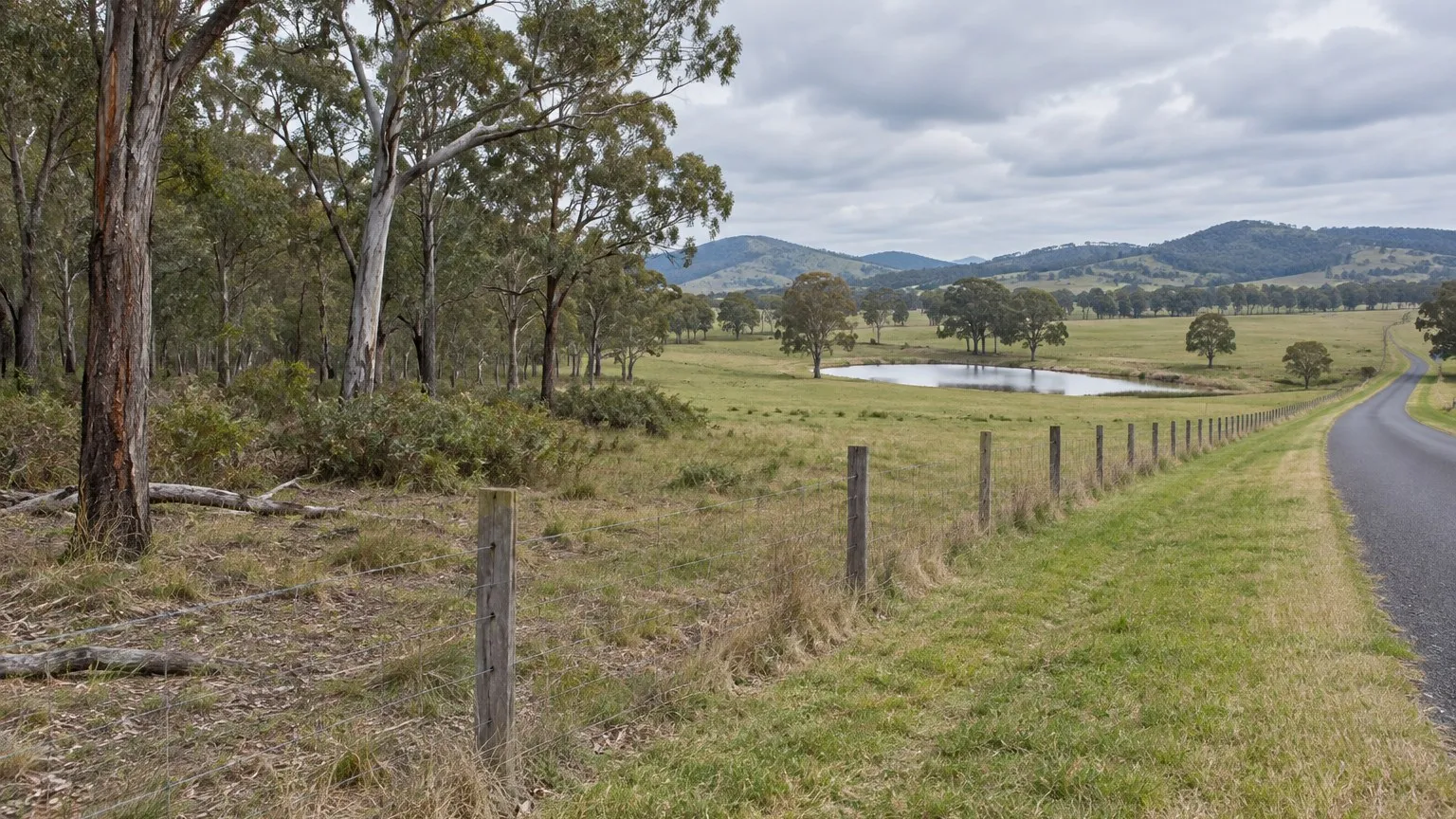
You find a rural-residential block with a real subdivision story. There is remnant timber along the boundary, a dam in the paddock, and enough area to create the lots the numbers need. Then your assessor tells you the clearing area may exceed the threshold and the Biodiversity Offsets Scheme may apply.
That is not a formality. It can produce an assessment cost, a redesign, and an offset obligation that is not visible anywhere in the land price.
The deal question: how many hectares does your footprint clear?
The Biodiversity Offsets Scheme is described by NSW Environment and Heritage as a mechanism to avoid, minimise and offset the impacts of development and some types of clearing on biodiversity in New South Wales. The scheme includes the Biodiversity Values Map and Threshold Tool, the Biodiversity Assessment Method, offset rules and provisions dealing with serious and irreversible impacts.
So the question at feasibility is specific and measurable. How much native vegetation does your proposed development footprint clear, and does that area cross the threshold that applies to this land?
The threshold is tied to minimum lot size, not to your project
This is the part that surprises people, and it is why the same clearing area can be a problem on one site and not on another.
The guidance on scheme entry requirements states that the scheme is activated by local development and clearing proposals that involve clearing native vegetation that exceeds the area clearing threshold, and that the threshold varies according to the relevant minimum lot size at the proposal site, as shown in the lot size maps made under local environmental plans, or the actual lot size where no minimum lot size is provided. Where there are multiple relevant minimum lot sizes, the smallest one applies.
The published thresholds are:
- Less than 1 hectare minimum lot size: 0.25 hectares or more of clearing.
- 1 hectare to less than 40 hectares: 0.5 hectares or more.
- 40 hectares to less than 1,000 hectares: 1 hectare or more.
- 1,000 hectares or more: 2 hectares or more.
Read that against a normal small-scale development. On land with a small minimum lot size, a quarter of a hectare is not much at all — a driveway, a building platform, services and a stormwater basin can approach it. The threshold is not designed to catch only large projects.
The inclusion rule that catches subdivisions
The total development footprint must be considered, and for a subdivision that has a consequence people often miss. The guidance states that where a new subdivision on rural land creates new boundaries or requires internal fence lines, any areas subject to new clearing entitlements as a direct result of the approved subdivision or development must be included in the proposed development. The stated purpose is to ensure the proposed development's total biodiversity impact is properly considered when determining entry requirements and any subsequent biodiversity development assessment report.
In plain terms: you can bring land into the calculation by creating lots, even if you are not clearing it now. That is exactly why the threshold calculation belongs with the layout options, not after them.
What does not count, and what counts more than you expect
There is a genuine exclusion. The guidance states that native vegetation on category 1 exempt land under Part 5A of the Local Land Services Act 2013 is not included in area clearing calculations when deciding whether a biodiversity development assessment report should be prepared, unless the native vegetation is assessed as a critically endangered ecological community, and that clearing on land meeting that definition does not require assessment or offsetting under the Biodiversity Assessment Method. For rural land the department recommends that accredited assessors first establish whether land is category 1 exempt land, and an application should clearly indicate that area with evidence-based justification.
The counterweight is just as real. Non-native vegetation, and vegetation that is dead or dying, on category 2 vulnerable regulated land must be considered in the same way as native vegetation for scheme entry requirements and assessments. A paddock that looks degraded on inspection is not automatically outside the calculation.
Who does the assessment, and what it costs you
Under the Biodiversity Conservation Act 2016 assessors must be accredited to apply the Biodiversity Assessment Method. The scheme's resources include a way to find an accredited assessor and to get a desktop estimate of likely offset obligations, and the Biodiversity Values Map and Threshold Tool is the published way to assess the threshold, check mapping and determine clearance criteria for a project.
Three cost lines follow, and only one is obvious:
- The assessment. An accredited assessor's work to establish the threshold result and, if the scheme applies, prepare a biodiversity development assessment report.
- Avoidance and minimisation. Layout changes that retain vegetation, protect the retained areas and reduce the clearing area. These cost design time and sometimes yield.
- The offset obligation. Biodiversity credits or an equivalent payment, quantified by the assessor and priced by you.
The third line is the one most often left out of a first-pass feasibility, because nothing in the purchase price or the council fee schedule hints at it.
The trap: assuming a cleared-looking paddock is outside the scheme
The first trap is visual. Land that has been grazed for decades still carries scattered remnant trees, regrowth and groundcover that may be native, and category 2 vulnerable regulated land brings non-native and dead or dying vegetation into the calculation as well. Deciding from a photograph that there is nothing to clear is not a finding the assessor will necessarily agree with.
The second trap is procedural. The threshold is measured against the total footprint, and a subdivision enlarges it. So the cheapest-looking layout, the one that maximises yield by pushing buildings and access across the block, may be the layout that triggers the scheme. The design decision and the environmental cost are the same decision, and it is much cheaper to make it on paper.
The site test a student would run, in order
- Get the minimum lot size for the land from the current local environmental plan lot size map. That number sets the threshold.
- Check the Biodiversity Values Map for the site and the proposed footprint.
- Map the clearing area for the total development footprint, including areas that would become clearable because of the subdivision and any internal fence lines.
- Test the land categories. Establish whether any part is category 1 exempt land, and identify any category 2 vulnerable regulated land.
- Run the threshold tool and, if it is close, commission an accredited assessor's desktop estimate before you fix the layout.
- Price the obligation into your feasibility with a contingency, then compare a reduced-clearing layout against the higher-yield one on numbers rather than preference.
What this does to the offer
Run the feasibility twice: the layout you want, and a layout that stays under the threshold or minimises the offset. If the second version is materially more profitable, the offset obligation is the deal, and your offer should reflect the cost of the first version rather than the optimism of the second.
For a sensitive-assumption test, ask what happens if the clearing area lands just above the threshold rather than just below. Threshold rules create a step change, not a gradual cost, and a model that treats the offset as a smooth percentage will not show you the cliff.
Practical next steps
You are not expected to solve this yourself. A town planner confirms the development application pathway and how the clearing question is dealt with in your consent. An accredited assessor, accredited under the Biodiversity Conservation Act 2016, calculates the threshold result and prepares any biodiversity development assessment report and the offset obligation. A quantity surveyor or your feasibility model prices the credits and the assessment into the project. Confirm the current minimum lot size and the land categories with the assessor before you commit to a layout, and do it before exchange.
Sources and boundaries
Sources checked 27 September 2026. Jurisdiction and limits: New South Wales specific information. This guide relies on NSW Environment and Heritage material about the Biodiversity Offsets Scheme, the area clearing threshold, the Biodiversity Values Map and Threshold Tool and the accredited assessor requirement under the Biodiversity Conservation Act 2016, together with the category 1 exempt land framework in Part 5A of the Local Land Services Act 2013. Whether the scheme applies to a particular proposal depends on the current lot size maps made under the relevant local environmental plan, the actual clearing area in the total development footprint, and the current Biodiversity Values Map. Thresholds, mapping, categories of regulated land and offset rules are updated, and the pages relied on here carry their own update dates. Major projects and biodiversity certification are treated differently from local development and are not covered by this guide. Other states and territories regulate native vegetation clearing and biodiversity offsets under their own legislation and must not be assessed against this guide. This is general information only. Confirm the current requirement with the relevant authority, an accredited assessor and your town planner before you commit money or sign a contract.
- NSW Environment and Heritage — The Biodiversity Offsets Scheme. Used for: the statement that the Biodiversity Offsets Scheme provides a mechanism to avoid, minimise and offset the impacts of development and some types of clearing on biodiversity in New South Wales; that the scheme includes the Biodiversity Values Map and Threshold Tool and the Biodiversity Assessment Method; that offset rules and serious and irreversible impact provisions apply; and that under the Biodiversity Conservation Act 2016 assessors must be accredited to apply the Biodiversity Assessment Method (page updated 1 June 2026) (Checked 27 September 2026)
- NSW Environment and Heritage — Biodiversity assessments and calculation of the scheme entry requirements. Used for: the statement that the area clearing threshold applies to local development and clearing proposals but not to major projects or biodiversity certification, because the scheme automatically applies to those; that the scheme is activated by local development and clearing proposals involving clearing native vegetation that exceeds the area clearing threshold; that the threshold varies according to the relevant minimum lot size at the proposal site shown in the lot size maps made under local environment plans, or the actual lot size where no minimum lot size is provided, and that where there are multiple relevant minimum lot sizes the smallest one applies; the published threshold table, being 0.25 hectares or more where the minimum lot size is less than 1 hectare, 0.5 hectares or more where it is 1 hectare to less than 40 hectares, 1 hectare or more where it is 40 hectares to less than 1,000 hectares, and 2 hectares or more where it is 1,000 hectares or more; that the total development footprint must be considered, including any areas subject to new clearing entitlements as a direct result of an approved subdivision; that native vegetation on category 1 exempt land under Part 5A of the Local Land Services Act 2013 is not included in area clearing calculations unless assessed as a critically endangered ecological community, and clearing on such land does not require assessment or offsetting under the Biodiversity Assessment Method; and that non-native vegetation or vegetation that is dead or dying on category 2 vulnerable regulated land must be considered in the same way as native vegetation for scheme entry requirements and assessments (Checked 27 September 2026)
- NSW Environment and Heritage — The Biodiversity Values Map and Threshold Tool. Used for: the description of the Biodiversity Values Map and Threshold Tool as the means to assess the Biodiversity Offsets Scheme threshold, check mapping and determine clearance criteria for a development project, including how to identify the development footprint and calculate the area clearing threshold (Checked 27 September 2026)
This article is general education, not personalised planning, legal, financial, tax, privacy, safety or building advice. Requirements and outcomes vary by jurisdiction, site, contract, structure and circumstances. Check current information with the relevant authority and appropriately qualified advisers.
 Learn with Jason & AmyBuild practical small-scale property development skills with experienced mentors.Enquire now
Rate this article
Guest rating: select 1 star for poor or 5 stars for great. No account is required.
Leave a comment
Join the discussion. Your email address will not be published.
Frequently asked questions
What actually causes the Biodiversity Offsets Scheme to apply?
Clearing native vegetation above a defined area. NSW Environment and Heritage states that the scheme is activated by local development and clearing proposals that involve clearing native vegetation that exceeds the area clearing threshold, and that the threshold applies to local development and clearing proposals but not to major projects or biodiversity certification, because the scheme automatically applies to those. So the practical question at feasibility is not whether you like the trees. It is how much native vegetation your proposed development footprint clears, and whether that area crosses the threshold for this land.
How is the threshold calculated?
It is tied to the minimum lot size for the land, which is why the same clearing area can trigger the scheme on one site and not another. The published table sets the threshold at 0.25 hectares or more where the relevant minimum lot size is less than 1 hectare, 0.5 hectares or more where it is 1 hectare to less than 40 hectares, 1 hectare or more where it is 40 hectares to less than 1,000 hectares, and 2 hectares or more where it is 1,000 hectares or more. Where there are multiple relevant minimum lot sizes, the smallest one applies. The threshold is shown in the lot size maps made under local environmental plans, or the actual lot size applies where no minimum lot size is provided.
Does the footprint include the whole site or just what I build on?
The total development footprint must be considered, and this is where subdivision projects get caught. The published guidance states that where a new subdivision on rural land creates new boundaries or requires internal fence lines, any areas subject to new clearing entitlements as a direct result of the approved subdivision or development must be included in the proposed development. In other words, creating lots can enlarge the footprint even though you are not clearing that land today. That inclusion rule is the reason a rural subdivision needs the threshold calculation run before the layout is fixed.
Does any land sit outside the calculation?
Yes, and it is worth checking properly. Native vegetation on category 1 exempt land under Part 5A of the Local Land Services Act 2013 is not included in area clearing calculations when deciding whether a biodiversity development assessment report should be prepared, unless the native vegetation is assessed as a critically endangered ecological community, and clearing on land meeting that definition does not require assessment or offsetting under the Biodiversity Assessment Method. For developments on rural land, the department recommends that accredited assessors first establish whether land is category 1 exempt land, and an application to a consent authority should clearly indicate that area with evidence-based justification. Note the counterweight: non-native vegetation and dead or dying vegetation on category 2 vulnerable regulated land must be treated the same way as native vegetation.
Who does the assessment, and what does it cost?
Under the Biodiversity Conservation Act 2016 assessors must be accredited to apply the Biodiversity Assessment Method, and the scheme's own resources include finding an accredited assessor and getting a desktop estimate of likely offset obligations. The cost of a deal has three parts: the assessment itself, any avoidance or minimisation measures that change your layout, and the offset obligation in the form of biodiversity credits or an equivalent payment. All three belong in your feasibility, and the offset component is the one most often omitted because it is invisible in the land price. Your accredited assessor quantifies the obligation; a quantity surveyor or your model prices it.
Loading comments…